Tuesday, July 23, 2019

Blue Lagoon National Park

We had just over 24 hours in Lusaka between the Lochinvar NP trip and our next trip -- barely enough time, it turns out, to try to wash all of one's dirty field clothes and supply of underpants before heading back out again. We put our washerwoman through the ringer trying to get all of our clothes washed (by hand) and hung to dry on Sunday -- a particular challenge because she was at church all morning. A good lesson in "do it yourself."

Waiting for our laundry to dry meant a later start than we'd hoped on our journey to Blue Lagoon National Park. We also had the challenge of shopping for what was going to be 6 days in the bush with six to nine people with un-finalized accommodation plans. Part of the challenge was estimating how much bottled water to bring, as we weren't likely to encounter potable water during the trip. [I can say, in retrospect, that we did bring enough food].

Blue Lagoon National Park is located north of the Kafue River just opposite of Lochinvar, where we'd been a few days earlier. 


(You may wonder why we didn't take the road that passes by Muteli instead of the road we took. Apparently that road is in even worse shape than the road we took!)
(The space between the parks is designated as a "Game Management Area" so has some level of protection but also has many human communities and impacts.)

The drive to Blue Lagoon is divided into two parts: the part between Lusaka and Kasula (North of the Park), which is a paved road, and the part between Kasula and the park, which is one of the worse roads we've driven on: unpaved and full of ruts and bumps and other adventures. Part I of our drive took a little over an hour. Part II took nearly two hours despite its shorter length.

But we did finally arrive at Nakeenda Lodge, our home for two nights. This is the only tourism facilities in the park and was quite manageable for experienced, flexible travelers ready to tent if needed. No running water; rather a barrel in the bathroom from which one scooped water for flushing the toilet, washing up, etc. We had power from a generator for a couple of hours in the evening and did all of our own cooking right on our little veranda. Gorgeous location. We arrived just before sundown, in time to take in the camp and a lovely walk along the two-track from the camp out into the park's floodplain. 


Early the next morning, we headed out on to a causeway built in the 1970s out into the floodplain. In the wet season, the entire floodplain is covered with water in most years, so the only way to get out to see things was to elevate one's self, hence the causeway. Time has taken its toll on the causeway and especially on the tower that had been built at the end of the causeway for looking out over the floodplain--a fire burned all but the metal frame of the tower. including steps, floorboards, and the thatched roof that once extended from the center pole. The metal frame made for good climbing by Theo and Ian.


The tower skeleton at the end of the causeway.
Fun climbing the stairs with no treads.

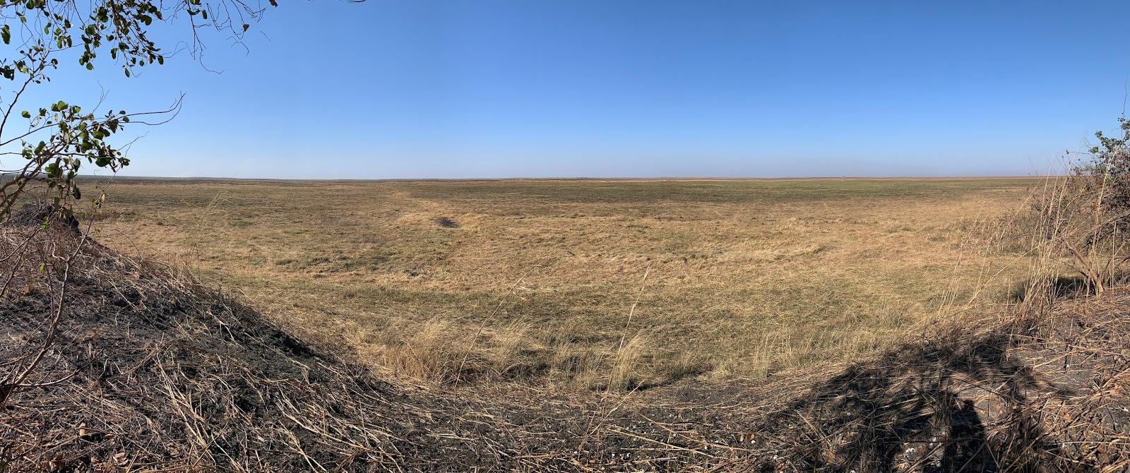
Pano of the floodplain from the causeway (excuse the little bit of distortion at the edges...).


Part of the floodplain is dry by this time of year, so we could drive out to the point where the plain was saturated. It was a bumpy and dusty/ashy ride (ashy from the fires that had burned much of the floodplain). But we were rewarded! That edge between saturated and dry plains happens to be where all the wildife also hang out, including Wattled Cranes and the endemic Kafue Lechwe. We saw about 600 cranes and way more lechwe than we could count -- as you looked out over the floodplain, you could see an line of lechwe along that saturation margin as far as your eyes could see in both direction. Amazing. At one point, Rich, Griffin and I ditched our boots and waded out through the shallow edge of the waters to try to get closer to the cranes and lechwe. The water felt great.

The view from inside the car for most of the day so long as the vehicle was moving. Happily we had lots of stops for good viewing.
The team at work, counting Wattled Cranes and enjoying the bounty of other waterbirds and wildlife out among the cranes at the waterline.
Three guys in a canoe came to talk with us. Turned out they were scouts on patrol and were curious about us.
Seriously dusty. Thank goodness for the bandanas to hide camping hair.

We had a relaxing afternoon in camp. Great tree for hammock hanging for reading and snoozing. Dinner of boerewors (coarsely minced beef and spices--toasted coriander seed, black pepper, nutmeg, cloves and/or allspice) in a tomato-based sauce with pasta. On to Kafue National Park next.


Moon behind our beautiful tree. Photo by Ian (posted before he had a chance to edit).

Sunday, July 14, 2019

Lochinvar National Park on the Kafue Flats

Our first field outing of the trip was to Lochinvar National Park on the south side of the Kafue River, about 250 km southwest of Lusaka -- a little more than a 4-hour drive.


The Kafue Flats are located along the Kafue River (a tributary of the Zambezi River) and are ecologically important for many reasons, including providing the most important wetland area for Wattled Cranes in Africa. Lochinvar National Park is one of two national parks on the Kafue Flats, the other being Blue Lagoon (stay tuned, as that’s next week’s field adventure!). You can see the Flats and the Kafue River on the above aerial photo (squiggly green line is the river, darker green around it, the Flats).

The International Crane Foundation has been involved in the Kafue Flats for more than 20 years (Rich and I were here back in 2001) and is embarking on a bigger project to restore and manage the flats in collaboration with the Zambian government and other partners. Our purpose on this trip: to check in on progress on a big invasive plant control project (removing a highly invasive shrub called mimosa that had taken over the entire shoreline, preventing use by the endemic Kafue lechwe (an antelope) and endangered Wattled Crane) and to look for Wattled Cranes, lechwe, and other waterbirds and animals.

We tented at a lovely camp along the shores of the Chunga Lagoon in a camp that had recently hosted the 150 guys from the local community hired to cut mimosa, so already set up was a kitchen area, campfire area, a latrine, and a shower closet. We arrived in the dark, so didn’t really know where we were until we woke up. Those three nights sleeping in a tent in the park were my best nights of sleep yet in Zambia! Incredible stars (despite a waxing moon), including scorpio and the southern cross. Mornings brought a cacophony of birdsong. Ian slept in his mosquito net-covered hammock.


With us in the camp were our host Griffin and his son Natchi; Floyd, who supervises the mimosa removal project; and Albert, who is a senior conservation police officer for National Parks & Wildlife.

The view of the lagoon from our camp.

Albert, Floyd, and Rich in the "kitchen."
Ian's sweet hammock setup.
The latrine.
The shower closet.


Day 1. We drove out to the new camp of the mimosa workers to see their progress and talk with their captains. They shared their lunch of nshima (thick cornmeal porridge), beans, and cooked cabbage in the lovely shade of a tree on the flat, flat floodplain. Nshima is eaten with one’s hands. Not surprisingly, Theo has taken to this permitted opportunity to eat with his hands (and he’s better at it than some of the rest of us).


Hippo tracks! I left my shadow in there for some perspective.
Griffin explains about genet scat to Natchi and Theo.
Scoping out the floodplain.
Theo takes a break from binoculars for a book.

The "green mambas" clearing mimosa from the floodplain.

The wetland-dependent Kafue lechwe, endemic to these Kafue Flats.

An amazing night at the campfire under the stars. Photo by Ian.


Day 2. We traveled in a hired fishing boat up to the north end of the lagoon (first sight: hippos just off our launch point) to visit some floodplain areas regularly frequented by Wattled Cranes. We saw some incredible wetlands and other sites along the way. We also stopped by Nyimba Fishing Camp, a permanent settlement in the middle of the floodplain. There we met a small, extremely terrified little girl, pushed to the foreground by her amused mother---the little one had never seen a white person before and was quaking with fear. Hopefully we eased her concerns. Seen in the village: tiny fish drying in the sun (harvesting of young fish poses a threat to a sustainable fishery) and a pool hall. We bought breem for lunch: a tasty native fish from the river. Yum. After a relaxing afternoon in camp, we drove out for a great sundowner on the floodplain (more lechwe and Wattled Cranes in the distance!).

Luscious papyrus in the morning light. Photo by Ian.

Natchi and Theo found a cool wooden bridge across a wet area.
Theo helps paddle the boat during a narrow stretch where we passed several other boats.
Hippos!!! Photo by Rich.
African fish eagle. Photo by Rich.
Griffin and Albert
Traffic out in the wetlands. This boat is carrying charcoal into the communities in the lagoon.
Boating to church. Note there are three boats here tied together to make a big raft of sorts.
Lily pad flower. Photo by Rich.
Black-winged kite. Photo by Rich.
Glossy ibis. Photo by Rich.
Reed cormorant. Photo by Rich.
One of thousands of cattle on the flats. This one was in the early stages of giving birth. Alas we couldn't hang around to see the result.
African spoonbill. Photo by Rich.
Breem bought from the village and cooked for our lunch.
The fishing village.
Curious kids in Nyimba fishing village. 
Tiny fish drying in the sun.
A pool hall! Would love to have seen the transport of this table way out there to the middle of the flats...


Sundown on the floodplain.


Day 3. As we headed out on our way out of the park, we visited an enormous baobab tree, the “drum rocks”, and Gwisho Hot Springs (alas, not the swim-in-able kind, but beautiful nonetheless). Then back to Lusaka.
An enormous baobab tree. We couldn't link hands around the tree even with 7 people, it was so big!
The drum rocks, thus called because of the drum-like sound made when you knock on the rock just around a hole (erosion has hollowed out a bit of this rock right below that hole).
Theo and Natchi at the entrance to the "cave" within the baobab tree. Five people could easily fit into that cave, it was so big. Griffin says it's thought the cave has been used by people for hundreds of years (or more).
Gwisho hot springs. You could see the water bubbling and steaming up out of the ground.
The water was hot enough that a soak was definitely out of the question.

A great first field adventure.

Photography on the Savannah

Photography on the Savannah By: Ian Beilfuss I finally got through editing the massive amount of photos I took on the Zambia trip, ...